“Fortunately, we’ve seen the intensity decrease quite a lot. Definitely not as heavy as it was during yesterday morning and during the day,” Mr Wood told ABC Radio.
“But we are still seeing persistent showers coming across the coast, and they’ll continue much of today and really for the foreseeable future, with a wet week ahead.”

Flood damage at Cattai Ridge Road at Maraylya, in Sydney’s outer north-west, on Wednesday.Credit:The Hills Police Area Command/Facebook
Ms Woodhouse said Sydneysiders “could be incredibly lucky and have a sunny break” but conditions would generally be cloudy, with showers and storms on and off for the next week.
She said the ground was “incredibly wet” from Tuesday’s activity and presented the risk of further water over roads and flooding “here and there”.
Parramatta River flowed over the ferry wharf at Charles Street on Tuesday.
“No ferries are running between Parramatta and Sydney Olympic Park due to flooding and debris in the river at Parramatta,” Transport for NSW said on Wednesday morning about the F3 service. “Consider alternative travel options.”
By Wednesday morning, the NSW State Emergency Service had received more than 880 requests for assistance and performed 22 flood rescues of people who had driven into floodwaters.
Randwick and Sydney city SES crews conducted flood rescues at Arncliffe Road in Wolli Creek and near Qantas Drive in Mascot.
Trains are again running to a reduced timetable on Wednesday and some services will be cancelled, as the Rail, Tram and Bus Union and state government work towards a resumption of the full weekday timetable, scheduled to begin on Monday.
The government has dropped its application against the union in the Fair Work Commission as protected industrial action and enterprise agreement negotiations continue.

Bronte Baths at Bronte Beach, in Sydney’s eastern suburbs, on Wednesday morning.Credit:Louise Kennerley
“Trains will run every 30 minutes on some Sydney Trains lines, and services will be stopping at all stations, so expect longer journey times. Buses replace trains on some lines as well,” Transport for NSW said on Wednesday.
“Please use alternative modes of transport where possible ... we expect there to be ongoing service disruptions this week.”
Loading
Mr Wood said in addition to the La Niña year, a low-pressure trough sitting over the Coral Sea was bringing in “a whole lot of moisture”.
“With easterly winds, it’s really just piling up on the coast,” he said.
The bureau has forecast 10 to 20 millimetres in Sydney on Wednesday, although some isolated locations could receive up to 40 millimetres.
A severe weather warning has also been issued for people in parts of the Northern Rivers.
“Heavy rainfall which may lead to flash flooding may develop north of Ballina later today and into Thursday. Six-hourly rainfall totals of 150 to 200 mm are likely,” the bureau said.
“Locations which may be affected include Tweed Heads, Murwillumbah, Mullumbimby, Byron Bay, Kyogle and Brunswick Heads.”
The Audley Weir in the Royal National Park and Oxford Falls Road in northern Sydney remained closed in both directions on Wednesday due to flooding.

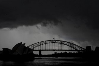
Sydneysiders should expect showers and storms on and off this week.Credit:Nick Moir
On Wednesday morning, there was water over the road at O’Riordan Street, in the inner-Sydney suburb of Beaconsfield, and also at Harris Street in Ultimo. Similar conditions were affecting traffic southbound on the Pacific Highway at St Leonards.
“Continue to take extra care on wet and slippery roads,” the Transport Management Centre said.
On the Central Coast, a flood warning was issued on Tuesday night for possible minor flooding on Tuggerah Lake at Long Jetty into Wednesday.
Our Breaking News Alert will notify you of significant breaking news when it happens. Get it here.


 Add Category