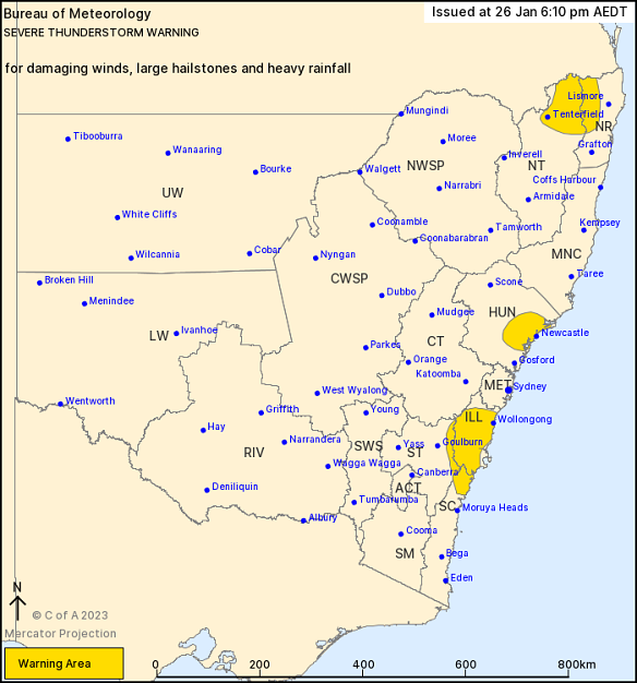
Almost all of Greater Sydney would be affected to some extent but conditions were not expected to reach levels of damage reported earlier in the week. There were more than 100 SES callouts after Tuesday night’s storms that inflicted more than 20,000 lightning strikes.
The weather bureau updated its earlier severe thunderstorm warning to focus the threat of damaging winds, large hailstone and heavy rain to the Illawarra coast, the Hunter and Newcastle coast and part of the Northern Rivers and Northern Tablelands.
The weather bureau had earlier issued a severe thunderstorm warning for a large inland area stretching from the Hunter in the north and down to Bega in the state’s south.
“There is potential for hail and damaging wind gusts mainly in the west but we can’t completely rule out that reaching the coast,” Phillips said.
Loading
“We have some of the key ingredients for storms, being warmth and high humidity ... the atmosphere is primed for storms, so we’ll have to wait and see.”
Phillips said the discrepancy between low total rainfall predictions and talk of storms were explained by the speed at which the storm was travelling east.
“If you are underneath one of those storms you’d get a heavy downpour but it wouldn’t last very long ... mainly about 10 minutes long,” he said.
“There won’t be high amounts of rainfall but if you are under a locally heavy rainfall you might see some flash flooding.”

Credit:Bureau of Meteorology
Our Breaking News Alert will notify you of significant breaking news when it happens. Get it here.


 Add Category