“If you don’t have to go out during the periods of extreme heat, please don’t.”
State Control Centre spokesperson Luke Heagerty said the heat – combined with strong winds – prompted bushfire fears on Monday.

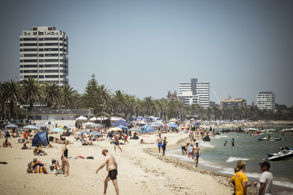
Albert Park beach on Sunday. Melbourne on Monday could hit a top of 41 degrees.Credit: Chris Hopkins
“It’s the first day this summer of that sort of level of significant danger across such a large part of the state,” Heagerty said.
“It’s probably the first time in a number of years where we’ve seen such high fire danger across ... anything in the west and central parts of the state.”
The summer scorcher comes after an early start to the fire season in Victoria, as blazes burnt parts of the state last month.
“Particularly in the west of the state, the grass has been dry for a couple of months now. That’s unusual to have it as dry as it has been as early as it has been this year,” Heagerty said.
“It’s pretty significant in terms of what it could signal for the rest of the summer.”
An extreme fire danger rating has been issued for six districts: the Mallee, Wimmera, Northern Country, North Central, South West and Central. A total fire ban has been declared for all those districts, as well as West and South Gippsland.
CFA chief executive Jason Heffernan said the fire ban would “reduce the risk of fires starting and spreading in dangerous weather conditions”.
“Any fire that starts could spread rapidly and threaten homes, communities and lives,” Heffernan said.
“Don’t wait until it’s too late to act.”
A cool change will bring some relief to the sweltering state, hitting Victoria’s west first and then moving east across the state
But Melburnians will have to wait until at least 7pm for a reprieve from the heat, said Bureau of Meteorology senior meteorologist Johnathan How.
“It could be very hot still ... in the high 30s to low 40s around dinnertime and then that cool change does come through into the evening,” he said.

Early heat in the city didn’t deter Melbourne runners and cyclists on Monday morning.Credit: Eddie Jim
How said the cool change would be prompted by thunderstorms, which could also bring the risk of dry lightning.
“It’s a pretty classic sort of example of summer weather for Melbourne,” he said.
Despite Monday’s persistent heat, it’s not anticipated to continue through to Tuesday, which has a milder forecast of showers and a maximum of 24 degrees in Melbourne.
“It is looking like a one-day heat spike,” How said.
An extreme heat timetable is in place for V/Line services, which means trains may run slowly and some services are replaced by buses.
The weather bureau’s summer forecast predicts higher-than-average temperatures and rainfall. Early forecasts show Christmas Day is currently expected to be dry and in the mid-to-high 20s.


 Add Category